

FlySpot Panorama
Turn photos from drones and regular cameras into 360° panoramas, then manage and share them with spatial data.
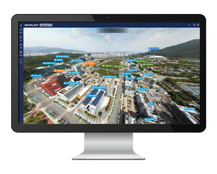
Upload your photos and get a panorama
Key features: easy panorama creation, spatial data, simple management, support for many devices, and linked spatial data and symbols.
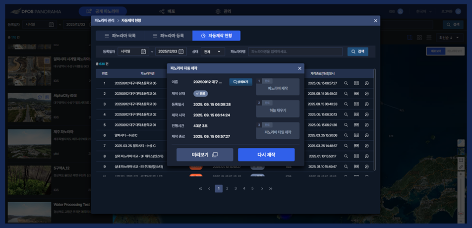
Panorama management
Register capture details and files to create panoramas automatically, then check progress or rebuild them.
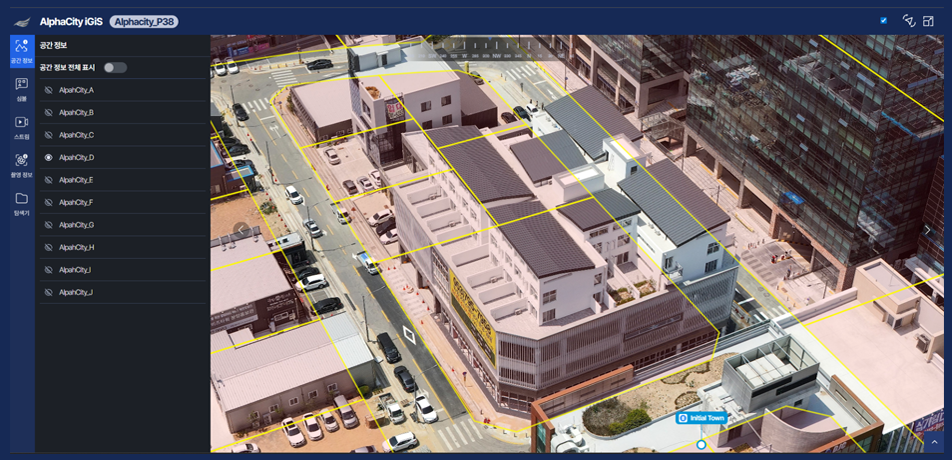
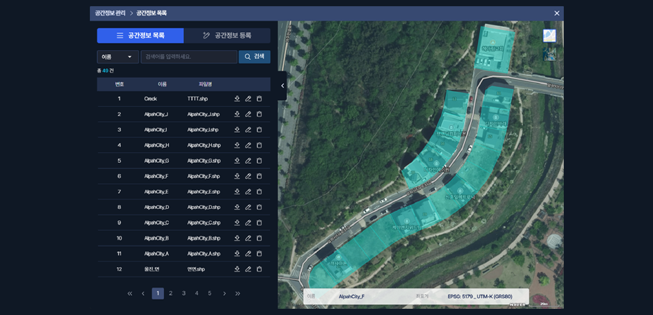
Spatial data management
Add, search, edit and download spatial data on panoramas.
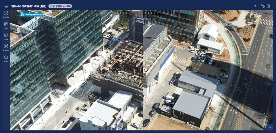
Panorama viewer
Compare the same location at different times in a split view, with symbols and capture details.
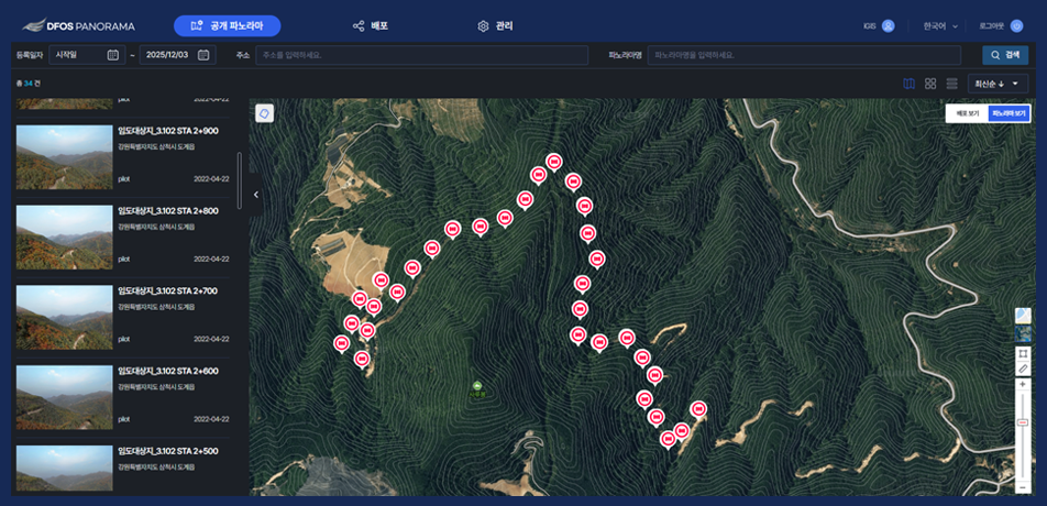
Publishing
Register panoramas to publish, set them public or private, and share them by URL.
Public panoramas
Search published panoramas and open them directly by URL.
Detailed features
View panoramas, attach spatial data and share them.
Panorama viewer
- Split view (same location, continuous)
- Spatial data settings and display
- Symbol creation and display
- Stream links, capture details
Spatial data
- List, search and view
- Add (details and files)
- Edit, delete and download
Publishing and sharing
- Public or private setting
- Copy the published URL
- View on PC, tablet and smartphone
With the Station
 With the Station
When the Station captures the same points on a schedule, time-series panoramas track how the site changes.
Other solutions
FlySpot Station
A drone station that dispatches with no one on site
ControlFlySpot Control System
Control multiple drones from one screen
DataFlySpot IMS
Large drone imagery, from upload to analysis
ControlFlySpot Streaming Viewer
A multi-viewer for live video from many sites
ControlFlySpot Weather
Drone weather and go/no-go flight decisions
FieldFlySpot Pilot
A flight app for sites without a station