

FlySpot IMS
Upload and manage large drone imagery on the web with nothing to install, and create orthomosaics automatically.
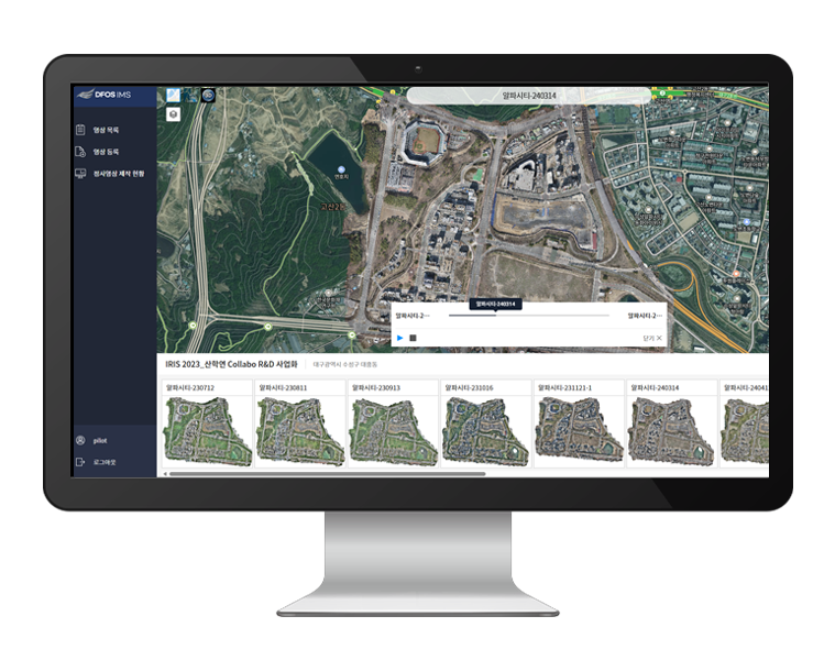
Hard-to-manage imagery, all in one place
Key features: integrated drone imagery management, automatic orthomosaics, search and filters, orthomosaic comparison and time-series analysis, and links between orthomosaics and source photos.
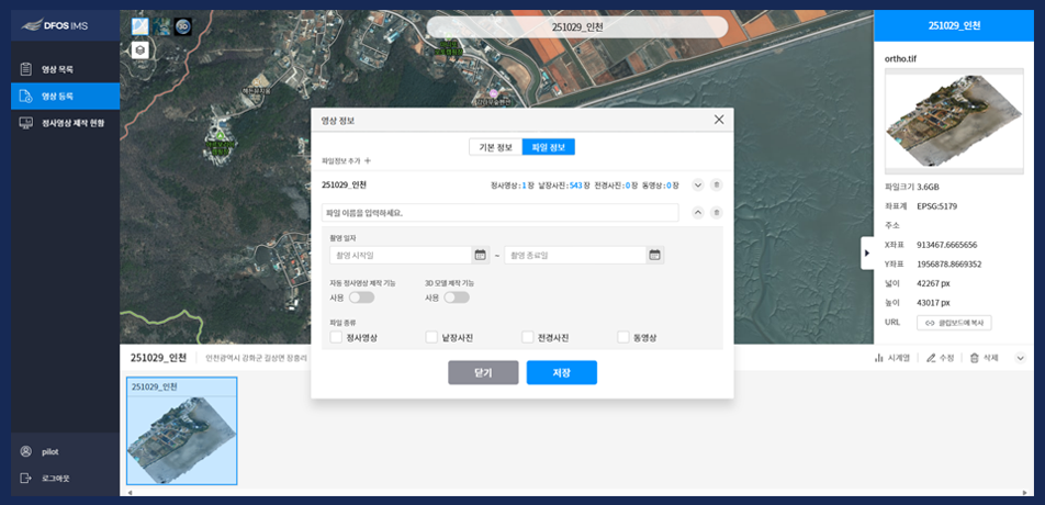
Imagery management
Register orthomosaics, single photos, overview photos and videos by area and date, and manage them in groups.
- Set image name and capture area
- Configure automatic orthomosaic creation
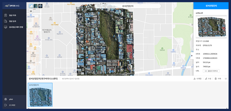
Imagery browsing
Check uploaded files and metadata, and overlay orthomosaics on the map to compare them.
- Copy the orthomosaic service URL
- Orthomosaic comparison, time-series analysis
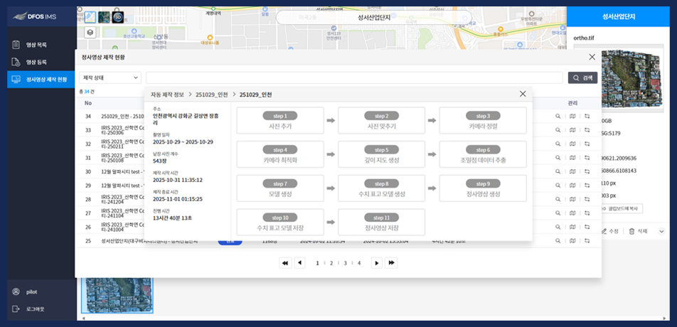
Orthomosaic progress
Create an orthomosaic from single photos in a few clicks and follow each processing step from anywhere.
- Search by status and name
- Step-by-step progress
Orthomosaics linked to source photos
Each automatic orthomosaic shows markers linked to the original photos. Click a marker to open the source photo.
Imagery services
- 2D and 3D imagery services
- Source photo markers
- Automatic service publishing
Imagery statistics
- Flight time per aircraft
- Flight area and distance
Web-based
- Nothing to install
- Anywhere with an internet connection
With the Station
 With the Station
Imagery captured by the Station flows into IMS automatically and is turned into orthomosaics.
Other solutions
FlySpot Station
A drone station that dispatches with no one on site
ControlFlySpot Control System
Control multiple drones from one screen
DataFlySpot Panorama
Record sites as they are in 360° panoramas
ControlFlySpot Streaming Viewer
A multi-viewer for live video from many sites
ControlFlySpot Weather
Drone weather and go/no-go flight decisions
FieldFlySpot Pilot
A flight app for sites without a station